North Scottsdale
Golf and master-planned communities in the high Sonoran desert, many of them gated, with mountain and city-light views.
Golf and master-planned communities in the high Sonoran desert, many of them gated, with mountain and city-light views.
Figures for October 2026 (the latest full month), from RentCast listings in ZIP 85255, one of North Scottsdale’s three ZIP codes.ZIP-wide median list price (single-family listings): RentCast, ZIP 85255 (one of North Scottsdale’s three ZIP codes), October 2026.ZIP-wide median days on market (single-family listings): RentCast, ZIP 85255 (one of North Scottsdale’s three ZIP codes), October 2026.Updated
Market figures: RentCast, from single-family listings (list prices, not closed sales) in each area’s main ZIP code. “To date” means the month so far. Silverleaf shares ZIP 85255 with North Scottsdale, so it shows no ZIP market figures of its own. Any figures shown are past results, not a forecast. Descriptions cover places and housing, not who lives there.
Drive times are by car without traffic, so off-peak; rush hour takes longer. They were measured on November 12, 2026 from the middle of North Scottsdale’s outline on this site’s map to each place’s nearest way in, using OSRM on OpenStreetMap roads.How the drive times were measured: Sky Harbor: Phoenix Sky Harbor International Airport, Terminal 4’s nearest edge; Old Town: Old Town Scottsdale: the nearer of Scottsdale Fashion Square, where Old Town starts, and the Scottsdale Civic Center at its middle; Scottsdale Airport: Scottsdale Airport (SDL), the City’s terminal building; Loop 101: the nearest Loop 101 interchange; OpenStreetMap: the roads and places routed on (© OpenStreetMap contributors); Project OSRM: the open routing engine used
Aaron’s sales
Aaron has closed 11 sales in North Scottsdale since August 2014.
McDowell Sonoran Preserve · protected since 1994 · six Preserve trailheads · Pinnacle Peak Park
The City of Scottsdale’s desert preserve, with over 230 miles of trails for hiking, biking and horseback riding. It’s free to use; e-bikes aren’t allowed.Source: City of Scottsdale, McDowell Sonoran Preserve (trails, trailheads, rules)
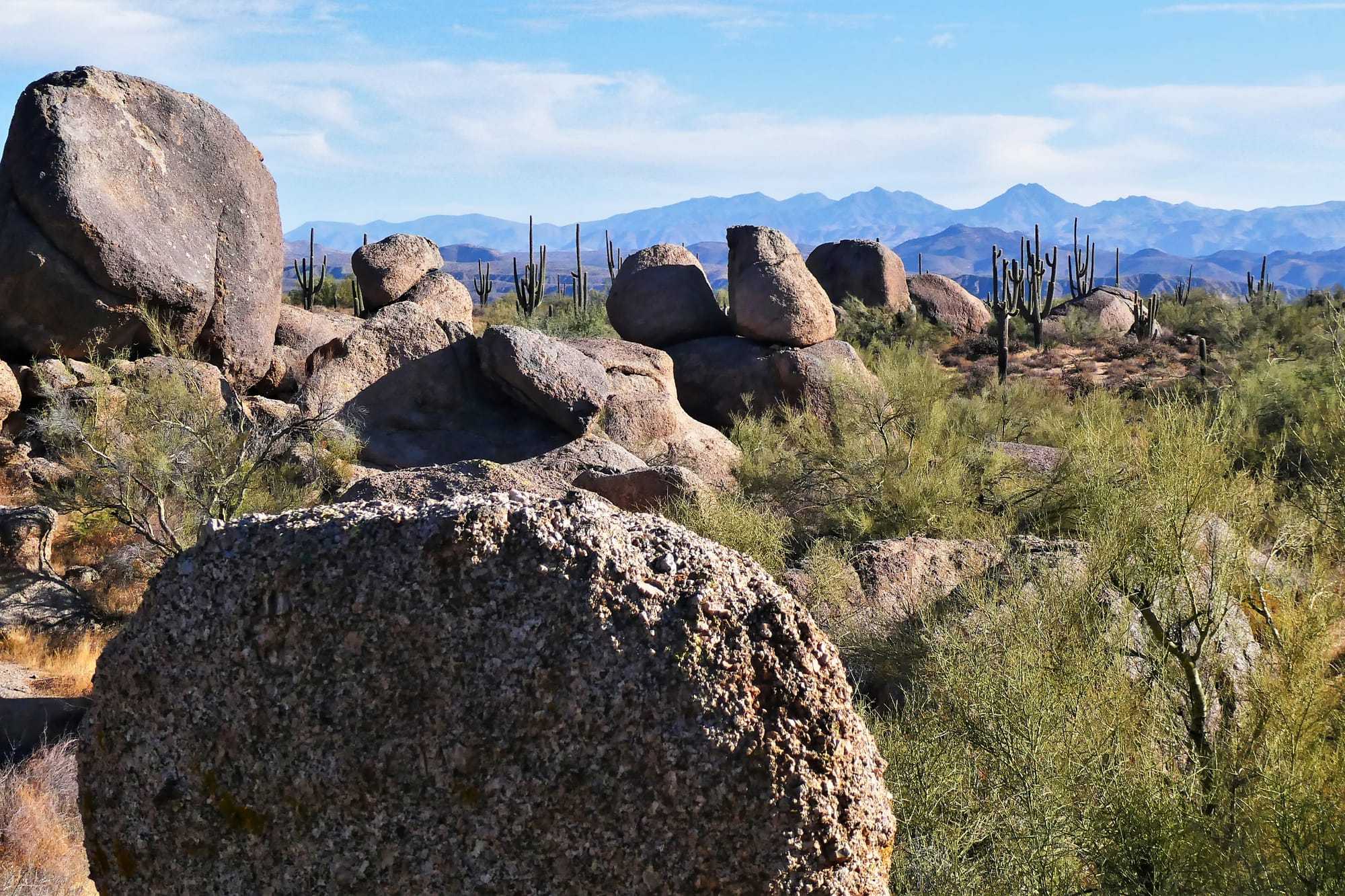
Near Granite Mountain in the McDowell Sonoran Preserve, looking east, November 2020. Photo: Scotwriter21, CC BY-SA 4.0, via Wikimedia Commons, cropped.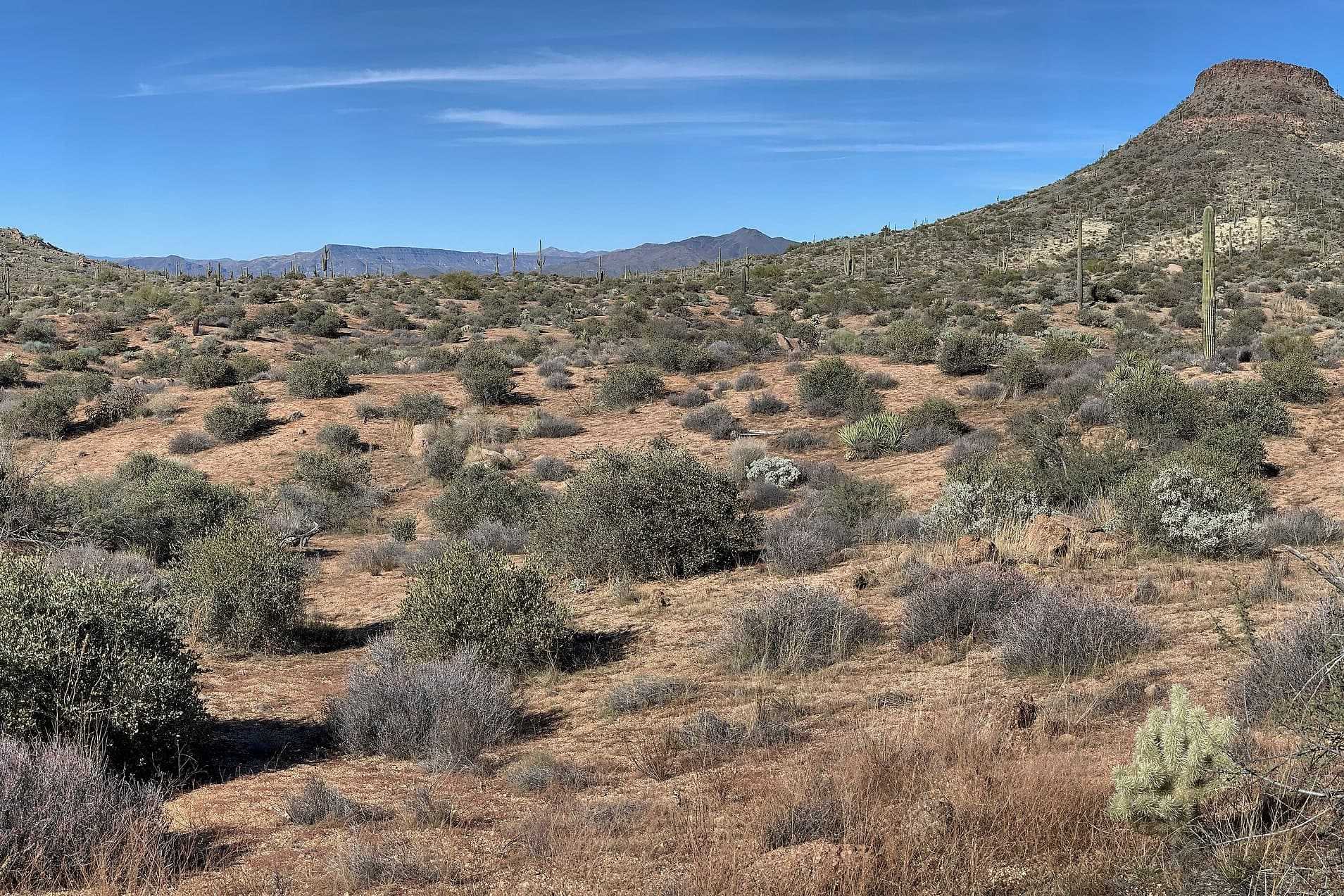
A Preserve trailhead about 14 minutes’ drive, with parking, restrooms, shade ramadas, water and the accessible Jane Rau Nature Trail. Dogs on a leash and bikes are allowed.Source: City of Scottsdale, McDowell Sonoran Preserve (trails, trailheads, rules); City of Scottsdale, Pinnacle Peak Park (dogs and bikes at Brown’s Ranch); OpenStreetMap: road distance and drive time by car from the middle of the area’s outline on this site’s map, routed with OSRM, without traffic, measured 2026-11-09; Project OSRM: the open routing engine used
The desert near Brown’s Ranch in the McDowell Sonoran Preserve, January 2022. Photo: Nicholas Hartmann, CC BY-SA 4.0, via Wikimedia Commons, cropped.A City park with one trail, 2 miles one way and 1,300 feet of climbing, about 10 minutes’ drive. Dogs and bikes aren’t allowed; the City points to Brown’s Ranch for both.Source: City of Scottsdale, Pinnacle Peak Park; OpenStreetMap: road distance and drive time by car from the middle of the area’s outline on this site’s map, routed with OSRM, without traffic, measured 2026-11-09; Project OSRM: the open routing engine used; City of Scottsdale map service: homeowner associations layer (associations named Pinnacle Peak; Pinnacle Peak Country Club Estates Association, 243 units); City of Scottsdale map service: subdivisions layer (Pinnacle Peak Country Club plats, 1976 to 1984); Pinnacle Peak Country Club: About Us (founded 1976, member-owned); Pinnacle Peak Country Club: Membership (not tied to property ownership)
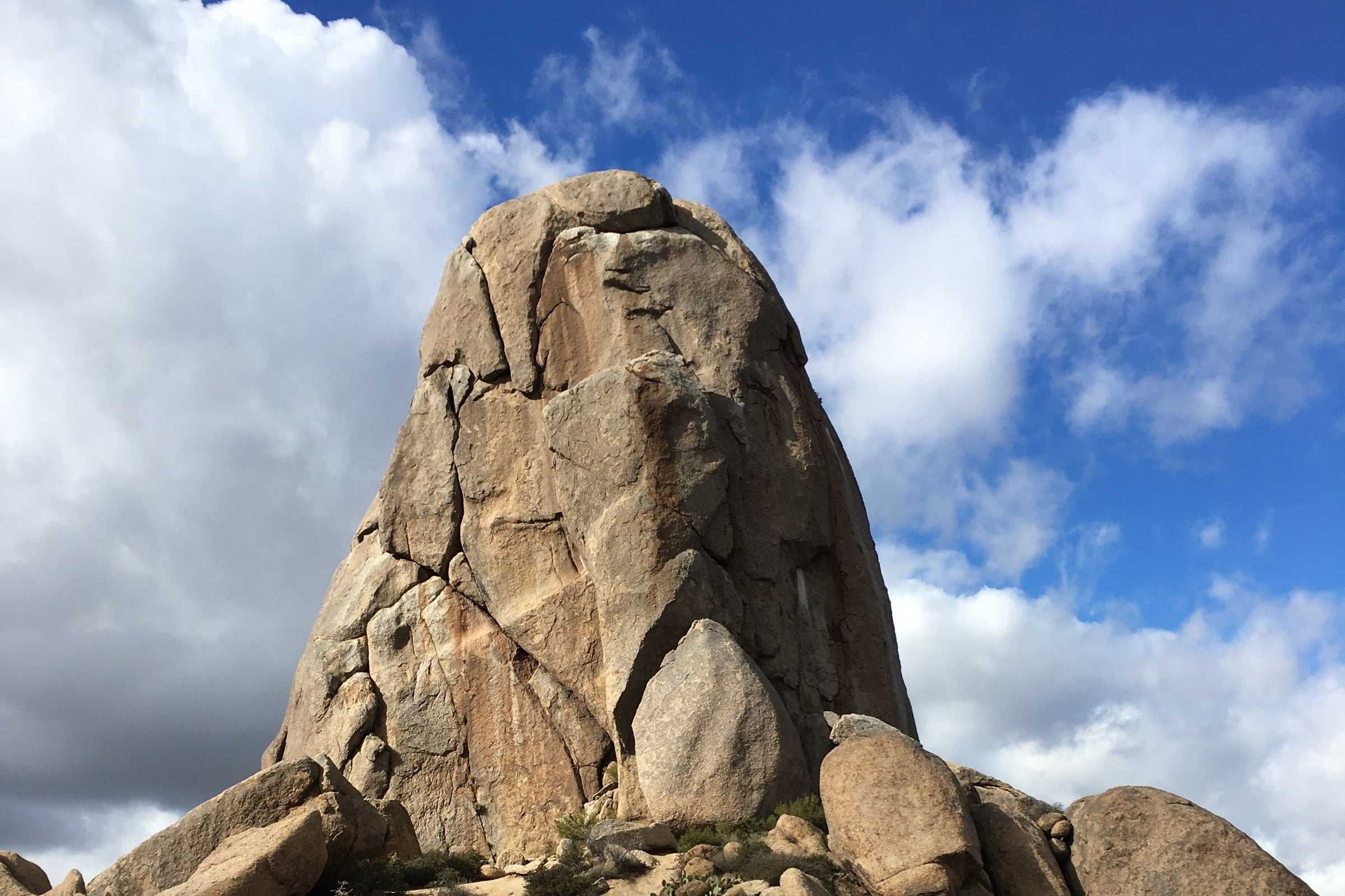
A Preserve trailhead about 11 minutes’ drive, with parking, restrooms and a shade ramada but no drinking water. The hike to Tom’s Thumb is 4.4 miles round trip.Source: City of Scottsdale, McDowell Sonoran Preserve (trails, trailheads, rules); City of Scottsdale, McDowell Sonoran Preserve south area trail map (PDF); OpenStreetMap: road distance and drive time by car from the middle of the area’s outline on this site’s map, routed with OSRM, without traffic, measured 2026-11-09; Project OSRM: the open routing engine used
A Preserve trailhead about 22 minutes’ drive, with parking, restrooms, shade ramadas, water and an accessible nature trail. The Gateway Loop is 4.4 miles round trip.Source: City of Scottsdale, McDowell Sonoran Preserve (trails, trailheads, rules); City of Scottsdale, McDowell Sonoran Preserve south area trail map (PDF); OpenStreetMap: road distance and drive time by car from the middle of the area’s outline on this site’s map, routed with OSRM, without traffic, measured 2026-11-09; Project OSRM: the open routing engine used
Two 18-hole courses, Monument and Pinnacle, below Pinnacle Peak, about 13 minutes’ drive. Its website books tee times, and it has a restaurant, the Dynamite Grille.Source: Troon North Golf Club: home; OpenStreetMap: road distance and drive time by car from the middle of the area’s outline on this site’s map, routed with OSRM, without traffic, measured 2026-11-09; Project OSRM: the open routing engine used
Drive times and distances are by road from the middle of the area’s outline on this site’s map, without traffic (OSRM on OpenStreetMap, measured November 9, 2026).
The search shows the homes inside North Scottsdale as the site’s map draws it, ZIP codes 85255, 85262 and 85266, Silverleaf included. Lots vary widely and many communities are gated, with HOAs, so set the lot size and HOA filters.
Search homes for sale from every brokerage that shares its listings through ARMLS, refreshed several times a day. Save the ones you like, with no account, and ask Aaron about any of them: he can show you any of these homes and represent you as your buyer’s agent.
Search homes for sale in North ScottsdaleA Scottsdale address vs. the city limits
Two homes with the same price per square foot can still differ on these.
Boundaries are approximate. The list and links on this page carry the same information.
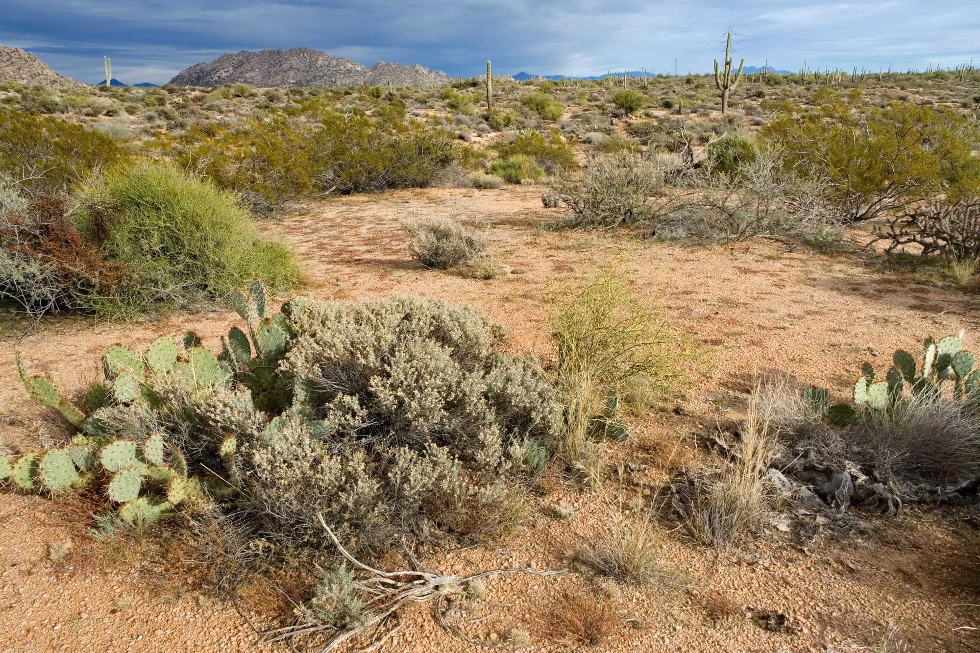
North Scottsdale’s ZIP codes reach into the City of Scottsdale’s McDowell Sonoran Preserve, protected since 1994, with over 230 miles of trails for hiking, biking and horseback riding. The City lists six Preserve trailheads in these ZIP codes, and its Pinnacle Peak Park is here too.Source: City of Scottsdale, McDowell Sonoran Preserve (hours, rules, trailheads and trail maps); City of Scottsdale, Pinnacle Peak Park; City of Scottsdale, Path & Trail System
From the middle of the area, the Tom’s Thumb Trailhead is about 11 minutes’ drive, Brown’s Ranch about 14 and Gateway, on Thompson Peak Parkway, about 22. The City also lists the Granite Mountain, Fraesfield and Pima Dynamite trailheads, in 85262.
Gateway and Brown’s Ranch have parking, restrooms, shade ramadas, water and an accessible nature trail. Tom’s Thumb, Granite Mountain and Fraesfield have restrooms but no drinking water, so bring your own.
The Preserve is free, and its trailheads open and close at set times through the year. Dogs must be on a handheld leash of six feet or less, and the City says that if it will be over 90 degrees during a hike, it’s too hot for a dog. E-bikes, scooters and other motorized devices aren’t allowed on its trails, apart from motorized wheelchairs and mobility exceptions the City approves.Source: City of Scottsdale, McDowell Sonoran Preserve (hours, rules, trailheads and trail maps); City of Scottsdale, McDowell Sonoran Preserve north/central area trail map (PDF); City of Scottsdale, McDowell Sonoran Preserve south area trail map (PDF); OpenStreetMap: road distance and drive time by car from the middle of the area’s outline on this site’s map, routed with OSRM, without traffic, measured 2026-11-09; Project OSRM: the open routing engine used
Show on the map
Pinnacle Peak Park, at 26802 N. 102nd Way, is about 10 minutes’ drive. Its one trail is 2 miles one way, with a cumulative elevation gain of 1,300 feet. Dogs and bikes aren’t allowed; the City points to the Brown’s Ranch Trailhead for both. Experienced climbers with the right gear can climb in three areas of the park.
Pinnacle Peak names a mountain, a City park, a road and a golf club, not one community. The City’s map of homeowner associations lists dozens with Pinnacle Peak in their names and no master association. Beside the park are Esperanza at Pinnacle Peak, The Reserve at Pinnacle Peak Patio, The Villages at Pinnacle Peak and Pinnacle Peak Place, and the gated communities of Estancia and Desert Highlands, which have pages of their own here.
Pinnacle Peak Country Club, at 8701 E. Pinnacle Peak Road, was founded in 1976 and is owned by its members, and the club says membership isn’t tied to owning a home. The homes around its course belong to the Pinnacle Peak Country Club Estates Association, which the City lists with 243 homes on eight plats recorded from 1976 to 1984.Source: City of Scottsdale, Pinnacle Peak Park; OpenStreetMap: road distance and drive time by car from the middle of the area’s outline on this site’s map, routed with OSRM, without traffic, measured 2026-11-09; Project OSRM: the open routing engine used
These are the golf and gated communities in North Scottsdale’s ZIP codes. Each row says only what the community’s or club’s own website says. Where a site doesn’t say whether its streets are gated, the table says so; the HOA’s documents will tell you.
| Community | Gated? | Golf | Aaron’s note |
|---|---|---|---|
| Desert Mountain | Yes: its club’s site describes gated access.Source: Desert Mountain Club: home (a private club; gated access) |
| Desert Mountain, in the far north of Scottsdale, is a gated community whose private club has seven golf courses, six of them Jack Nicklaus Signature courses. In Aaron’s experience, it’s farther from the city and its grocery stores than DC Ranch or Silverleaf. |
| DC Ranch | Some: the association runs 23 gates, staffed and unstaffed, and every Desert Parks neighborhood has gated access. Some neighborhoods have no gate.Source: DC Ranch: Community Patrol & Gate Access (23 gates, gatehouses); DC Ranch: Residential Villages | DC Ranch is a master-planned community of residential villages in north Scottsdale. Its association runs 23 gates, some staffed and some not, so ask which apply to a given home. Its golf club is The Country Club at DC Ranch, and Market Street at DC Ranch has shops and a grocery store. | |
| Silverleaf | Inside DC Ranch’s gates: the association’s gate page lists a gatehouse giving access for the Silverleaf Club.Source: DC Ranch: Community Patrol & Gate Access (Horseshoe: access for Silverleaf Club); The Silverleaf Club: home (a private club) |
| Silverleaf is a gated village within DC Ranch, at the base of the McDowell Mountains, with custom estates and villas. The private Silverleaf Club, with Tom Weiskopf’s 18-hole, par-72 course, a spa, pools and dining, is for its members. |
| Troon Village | Some: its association lists gated, guard-gated and non-gated subdivisions.Source: Troon Village Association: home (gated, guard-gated and non-gated subdivisions; Troon Country Club) | ||
| Troon North | Some: its Candlewood Estates neighborhood says it’s gated, with a staffed main entrance. The master association doesn’t describe Troon North as gated.Source: Troon North Golf Club: home; Candlewood Estates at Troon North: About (a gated community; main entrance staffed); Troon North Association: home (Internet Archive copy of July 14, 2025) | Troon North has the Troon North Golf Club, with two 18-hole courses, Monument and Pinnacle. Candlewood Estates says it’s gated, with a staffed main entrance; the master association doesn’t describe Troon North as gated. Check each subdivision. | |
| Estancia | Yes: its club’s site says it’s inside a gated community, with a staffed gate on Dynamite Boulevard.Source: The Estancia Club: home (a private club, membership by invitation); The Estancia Club: Driving Directions (a gated community; staffed gate on Dynamite Blvd.) |
| The Estancia Club, at Estancia, is a private club you join by invitation. Its 18-hole course is by Tom Fazio, and the clubhouse patio looks out on Pinnacle Peak. The club says Estancia is a gated community. |
| Desert Highlands | Yes: its community map marks a Main Gate and a West Gate to Pima Road.Source: Desert Highlands: home (a private club community); Desert Highlands: community map (Main Gate; West Gate to Pima Rd.) (PDF) |
| |
| Terravita | Yes: its club’s site calls it a gated community.Source: Terravita Golf & Country Club: home (a gated community; a member-owned private club) |
| |
| Grayhawk | Some: its association calls the Retreat Village the gated part of Grayhawk. The Park isn’t gated, apart from its Pinnacle neighborhood.Source: Grayhawk Community Association: Retreat Village Gate Access; Grayhawk Community Association: 2026 Schedule of Assessments (Pinnacle’s gated entry) |
|
An 18-hole course.Source: Legend Trail Golf Club: home
A 7,118-yard, par 72 course.Source: Arcis Golf: McDowell Mountain Golf Club
TPC Scottsdale straddles the line with Central Scottsdale and is listed there.
Every golf club in Scottsdale and Paradise Valley, compared
The Gateway Loop is 4.4 miles round trip from the trailhead, with an elevation change of 655 feet.Source: City of Scottsdale: McDowell Sonoran Preserve, trailheads; City of Scottsdale: McDowell Sonoran Preserve, South Area Trail Map (Spring 2026)
The hike to Tom’s Thumb is 4.4 miles round trip from the trailhead, with an elevation change of 1,027 feet.Source: City of Scottsdale: McDowell Sonoran Preserve, trailheads; City of Scottsdale: McDowell Sonoran Preserve, South Area Trail Map (Spring 2026)
One trail, about 2 miles one way, with a cumulative elevation gain of 1,300 feet; no dogs or bikes.Source: City of Scottsdale: Pinnacle Peak Park; City of Scottsdale: Pinnacle Peak Park, Rules and Safety
Gateway and Tom’s Thumb are round trips from the trailhead. City of Scottsdale: South Area Trail Map (PDF)
The City posts heat warnings for hikers and dog owners on its Preserve page; check it before a warm-weather hike. City of Scottsdale: McDowell Sonoran Preserve
Mixed-use shopping center in DC Ranch, at 20789 N. Pima Road.Source: Whitestone REIT: Market Street at DC Ranch
Neighborhood shopping center on Pinnacle Peak Road.Source: Whitestone REIT: La Mirada
Shopping center on Scottsdale Road in Grayhawk.Source: YAM Properties: Grayhawk Plaza
Community shopping center on Scottsdale Road, with Ace Hardware and Walgreens among its anchors.Source: Whitestone REIT: Terravita Marketplace
From Grayhawk or DC Ranch, in the area’s southwest, these distances are shorter.
Scottsdale Promenadeabout 12 miles
Shopping and dining center
Desert Ridge Marketplaceabout 12 miles
Shopping, dining and entertainment center
Scottsdale Quarterabout 12 miles
Shopping, dining and entertainment district
Kierland Commonsabout 12 miles
Open-air shopping and dining center
Distances are by road, from the middle of the area’s outline on this site’s map.Source: OpenStreetMap: road distances by car from the middle of the area’s outline on this site’s map, routed with OSRM and measured 2026-11-08; Project OSRM: the open routing engine used
School districts covering North Scottsdale as this page’s map draws it: Cave Creek Unified, Scottsdale Unified and Paradise Valley Unified. Part of North Scottsdale as the map draws it lies in no school district on the federal map.
Which school a home is assigned to depends on the address. Confirm it with Cave Creek Unified’s school finder, Scottsdale Unified’s school finder and Paradise Valley Unified’s school finder.
The Arizona Department of Education publishes a report card for every public school: azreportcards.azed.gov.
District boundaries from the U.S. Department of Education’s public data (2024–25). Aaron doesn’t rate or recommend schools.Source: National Center for Education Statistics, EDGE School District Boundaries (TIGER/Line 2025, school year 2024-25)
Aaron finds North Scottsdale quieter than the middle of the city, with more open desert and mountain views. Its public trails start at the City’s McDowell Sonoran Preserve trailheads, such as Brown’s Ranch, Tom’s Thumb and Gateway, and at Pinnacle Peak Park, whose trail runs 2 miles one way.
Not necessarily, because this site’s North Scottsdale follows ZIP codes 85255, 85262 and 85266, and a ZIP code is a postal area rather than a city limit. Check a specific address with the Maricopa County Assessor and the city.Source: Maricopa County Assessor
Mostly homes built from the 1990s onward, many in golf and master-planned communities. Lot sizes vary, and many are smaller lots within HOAs.
Yes, HOAs are common there, and many communities are gated. Read the CC&Rs before you buy: they’re recorded against the property, and buying there binds you to them.Source: Arizona Department of Real Estate and Arizona REALTORS®, Buyer Advisory (January 2025)
It’s a set of zoning regulations for about 134 square miles of Scottsdale’s desert and mountain areas, north and east of the Central Arizona Project canal. It requires part of each property to stay natural as open space, and the share depends on the landform and slope. Check it before you plan an addition or pool.Source: City of Scottsdale, Environmentally Sensitive Lands overlay
Mostly not: walkability is low, and you drive for most errands. On foot, it’s trails: the City of Scottsdale’s McDowell Sonoran Preserve has trailheads in these ZIP codes, among them Gateway, Tom’s Thumb, Brown’s Ranch and Granite Mountain, and the City’s Pinnacle Peak Park has a trail of 2 miles one way. The Preserve’s trails are open to hikers, bikers and horse riders, but not to electric bikes.Source: City of Scottsdale, McDowell Sonoran Preserve (hours, rules, trailheads and trail maps); City of Scottsdale, Pinnacle Peak Park
In places such as Rio Verde and Cave Creek, Aaron first checks the water: the water rights, whether there’s a well on the property, or whether water has to be hauled. Water is critical in Arizona, so he makes sure the utility is on site, and if it isn’t, that buyers understand what that means. Septic is the other check: some parts of Maricopa County, and places outside it, use septic tanks where sewers aren’t available.
Yes, Aaron has worked on land and lot sales. Having a survey and permits in hand helps, but when they aren’t available, a land buyer needs to know the area and the rules and restrictions on the land.
General information, not legal, tax or financial advice. Your own contract controls, and your attorney, tax professional or other advisers can confirm what applies to you.
Rules and figures can change.
See North Scottsdale beside any of the other ten areas: lots, homes, HOAs, setting and walkability.
Ask him about the streets, the homes and the tradeoffs, in person, by phone or on video.
Still deciding whether to move? That’s a good time to talk.
Call 602-785-5095Text 602-785-5095