Biltmore
The area around the Arizona Biltmore resort and golf courses, with condos, patio homes and custom estates near shopping and dining.
The area around the Arizona Biltmore resort and golf courses, with condos, patio homes and custom estates near shopping and dining.
Figures for October 2026 (the latest full month), from RentCast listings in ZIP 85016, which extends beyond Biltmore.ZIP-wide median list price (single-family listings): RentCast, ZIP 85016 (which extends beyond Biltmore), October 2026.ZIP-wide median days on market (single-family listings): RentCast, ZIP 85016 (which extends beyond Biltmore), October 2026.Updated
Market figures: RentCast, from single-family listings (list prices, not closed sales) in each area’s main ZIP code. “To date” means the month so far. Silverleaf shares ZIP 85255 with North Scottsdale, so it shows no ZIP market figures of its own. Any figures shown are past results, not a forecast. Descriptions cover places and housing, not who lives there.
Drive times are by car without traffic, so off-peak; rush hour takes longer. They were measured on November 12, 2026 from the middle of Biltmore’s outline on this site’s map to each place’s nearest way in, using OSRM on OpenStreetMap roads.How the drive times were measured: Sky Harbor: Phoenix Sky Harbor International Airport, Terminal 4’s nearest edge; Old Town: Old Town Scottsdale: the nearer of Scottsdale Fashion Square, where Old Town starts, and the Scottsdale Civic Center at its middle; Scottsdale Airport: Scottsdale Airport (SDL), the City’s terminal building; Loop 101: the nearest Loop 101 interchange; OpenStreetMap: the roads and places routed on (© OpenStreetMap contributors); Project OSRM: the open routing engine used
Aaron’s sales
Aaron has closed 3 sales in Biltmore since August 2014.
Arizona Canal · Piestewa Peak trailhead about 9 minutes’ drive · Arizona Biltmore Golf Club · Biltmore Fashion Park
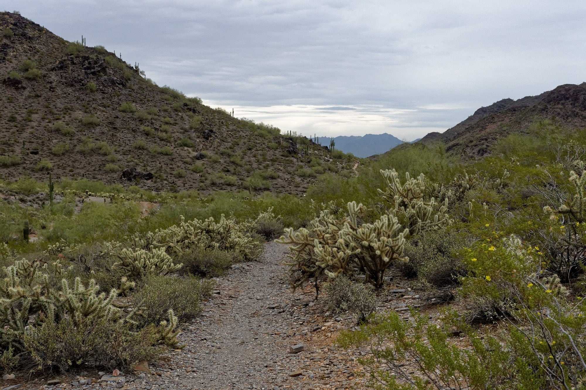
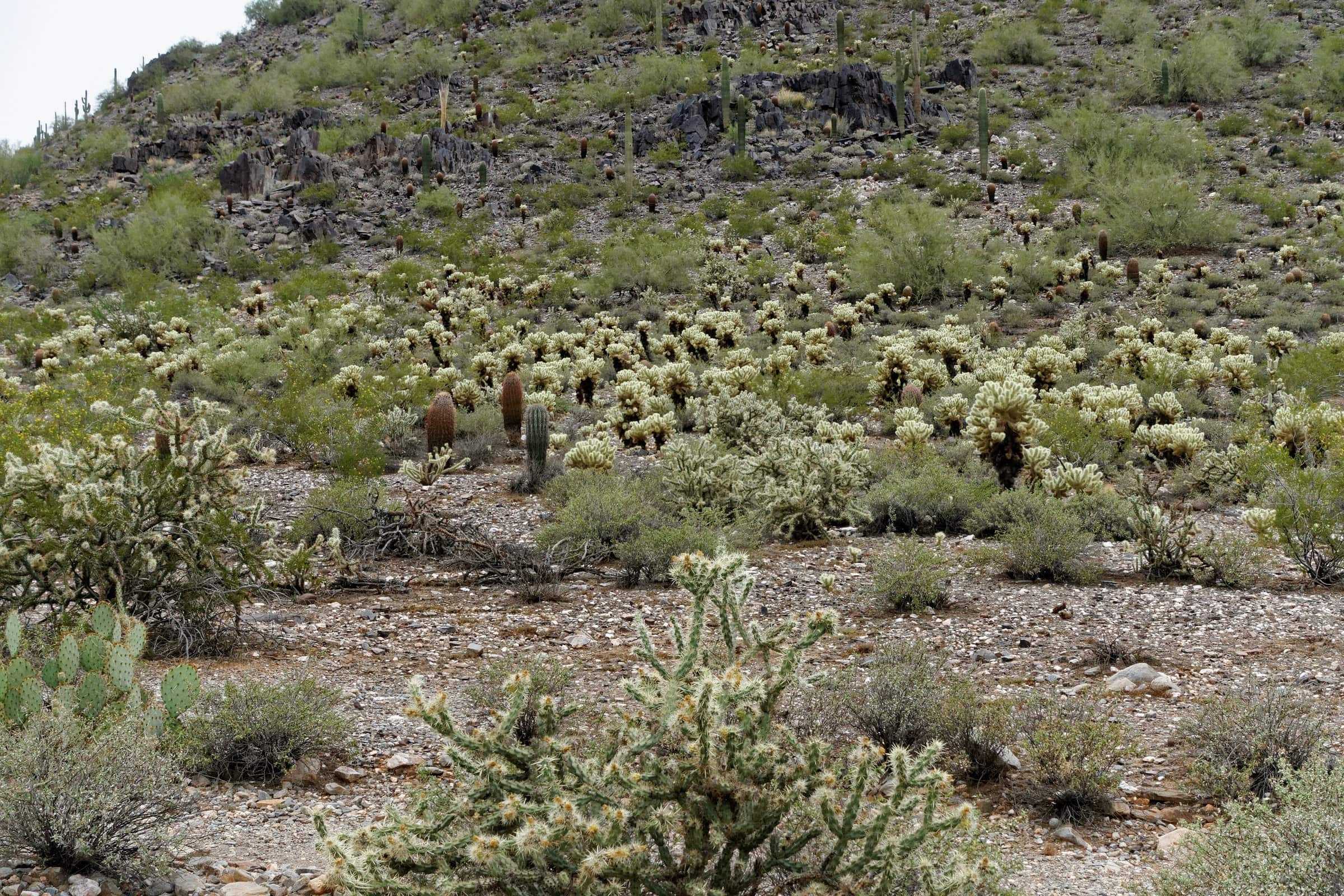
The City of Phoenix’s mountain preserve just north of Biltmore, with trailheads off Piestewa Peak Drive and at Dreamy Draw. Several have a restroom and drinking fountain.Source: City of Phoenix, Piestewa Peak / Dreamy Draw trails
A trail in the Phoenix Mountains Preserve, June 2015. Photo: KimonBerlin, on Flickr, CC BY-SA 2.0, via Wikimedia Commons, cropped.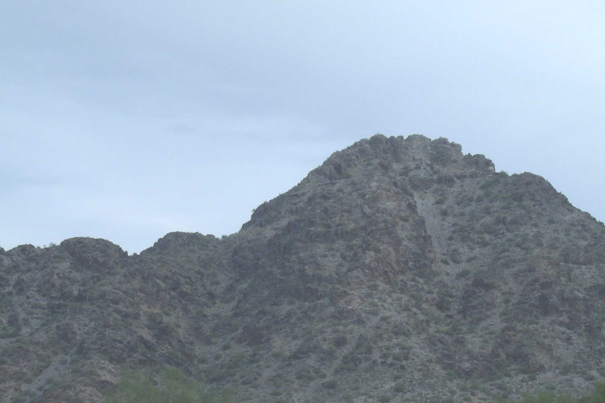
A 1.2-mile summit trail the City rates “Extremely Difficult,” about 9 minutes’ drive, with water, parking and restrooms at its base. It closes part of the day in extreme heat.Source: City of Phoenix, Piestewa Peak / Dreamy Draw trails; City of Phoenix, Heat safety (limited hiking during extreme heat); OpenStreetMap: road distance and drive time by car from the middle of the area’s outline on this site’s map, routed with OSRM, without traffic, measured 2026-11-09; Project OSRM: the open routing engine used
Piestewa Peak, February 2015. Photo: Tony the Marine, CC BY-SA 3.0, via Wikimedia Commons, cropped.The Arizona Biltmore’s two courses, the Links (par 71) and the Estates, about 4 minutes’ drive. They’re open to members and the public, with tee times through the club.Source: Arizona Biltmore Golf Club: the Links Course; Arizona Biltmore Golf Club: the Estates Course; OpenStreetMap: road distance and drive time by car from the middle of the area’s outline on this site’s map, routed with OSRM, without traffic, measured 2026-11-09; Project OSRM: the open routing engine used
SRP’s canal-bank trail across Biltmore, north of Camelback Road. It’s free to use on foot or by pedal bike; e-bikes, scooters and swimming aren’t allowed.Source: SRP, Canal trails; SRP, Canal safety; OpenStreetMap: the Arizona Canal across Biltmore, measured 2026-11-08
An outdoor shopping and dining center about 4 minutes’ drive away, with over 60 shops and places to eat and a Life Time fitness club.Source: RED Development, Biltmore Fashion Park; OpenStreetMap: road distance and drive time by car from the middle of the area’s outline on this site’s map, routed with OSRM, without traffic, measured 2026-11-09; Project OSRM: the open routing engine used
Drive times and distances are by road from the middle of the area’s outline on this site’s map, without traffic (OSRM on OpenStreetMap, measured November 9, 2026).
The search shows the homes inside Biltmore as the site’s map draws it, about 16th Street to 32nd Street and Indian School Road to Glendale Avenue, less Paradise Valley; ZIP 85016 extends beyond it. Homes run from condos and patio homes to custom estates, so the property type filter does the most here.
Search homes for sale from every brokerage that shares its listings through ARMLS, refreshed several times a day. Save the ones you like, with no account, and ask Aaron about any of them: he can show you any of these homes and represent you as your buyer’s agent.
Search homes for sale in BiltmoreHow to search for and buy a home here
Boundaries are approximate. The list and links on this page carry the same information.
Biltmore sits along the Arizona Canal, with the City of Phoenix’s Phoenix Mountains Preserve and Piestewa Peak just to the north. The Arizona Biltmore Golf Club’s two courses are in the middle of it, and Biltmore Fashion Park, with over 60 shops and places to eat, is about 4 minutes’ drive.Source: OpenStreetMap: the Arizona Canal, Camelback Road and Piestewa Peak, measured 2026-11-08; SRP, Canal trails; City of Phoenix, Heat safety (limited hiking during extreme heat); City of Phoenix, Piestewa Peak trails; Arizona Biltmore Golf Club; RED Development, Biltmore Fashion Park; OpenStreetMap: road distance and drive time by car from the middle of the area’s outline on this site’s map, routed with OSRM, without traffic, measured 2026-11-09; Project OSRM: the open routing engine used
SRP’s canal trail follows the Arizona Canal across Biltmore, north of Camelback Road. It’s free to walk, run or ride a pedal bike. E-bikes, scooters and other motor vehicles aren’t allowed, and neither is swimming, and SRP closes sections now and then for maintenance.Source: OpenStreetMap: the Arizona Canal, Camelback Road and Piestewa Peak, measured 2026-11-08; SRP, Canal trails; SRP, Canal safety
Show on the map
The Piestewa Peak Summit Trail starts at the Mesquite Trailhead, 2701 E. Piestewa Peak Dr., about 9 minutes’ drive. It’s 1.2 miles out and back with 1,200 feet of elevation change, and the City rates it “Extremely Difficult.” There’s water, parking and restrooms at the base.
The preserve around it has more trailheads off Piestewa Peak Drive and at Dreamy Draw, several with a restroom and drinking fountain. On days with an Extreme Heat Warning, the City closes the Piestewa Peak trails for part of the day.Source: OpenStreetMap: road distance and drive time by car from the middle of the area’s outline on this site’s map, routed with OSRM, without traffic, measured 2026-11-09; Project OSRM: the open routing engine used; City of Phoenix, Piestewa Peak trails; City of Phoenix, Heat safety (limited hiking during extreme heat)
Show on the map
The Arizona Biltmore Golf Club, beside the Arizona Biltmore resort and about 4 minutes’ drive, has two courses, the Estates and the Links. It’s open to members and the public, with tee times through the club.Source: Arizona Biltmore Golf Club; Arizona Biltmore Golf Club: the Links Course; Arizona Biltmore Golf Club: the Estates Course; OpenStreetMap: road distance and drive time by car from the middle of the area’s outline on this site’s map, routed with OSRM, without traffic, measured 2026-11-09; Project OSRM: the open routing engine used
Show on the map
Outdoor shopping center.Source: RED Development: Biltmore Fashion Park
Open-air shopping center.Source: RED Development: The Shops at Town & Country
Outdoor shopping center.Source: RED Development: Camelback Colonnade
Scottsdale Fashion Squareabout 7 miles
Regional mall
Old Town Scottsdaleabout 8 miles
Downtown district of shops and restaurants
The Shops at Gainey Villageabout 10 miles
Shopping center
The Pavilions at Talking Stickabout 10 miles
Shopping center
Distances are by road, from the middle of the area’s outline on this site’s map.Source: OpenStreetMap: road distances by car from the middle of the area’s outline on this site’s map, routed with OSRM and measured 2026-11-08; Project OSRM: the open routing engine used
School districts covering Biltmore as this page’s map draws it: Phoenix Union and Madison School District.
Which school a home is assigned to depends on the address. Confirm it with Phoenix Union’s school finder and Madison School District’s school finder.
The Arizona Department of Education publishes a report card for every public school: azreportcards.azed.gov.
District boundaries from the U.S. Department of Education’s public data (2024–25). Aaron doesn’t rate or recommend schools.Source: National Center for Education Statistics, EDGE School District Boundaries (TIGER/Line 2025, school year 2024-25)
Biltmore is close to Biltmore Fashion Park’s high-end shopping and to the Arizona Biltmore Golf Club’s two courses, both open to members and the public. The Estates, an all-new course by Tom Lehman and the Lehman Design Group on the site of the original Adobe Course, opened in November 2023; it’s 18 holes, par 71 and 6,669 yards. The Links is 18 holes and par 71.
No, Biltmore is an area of the City of Phoenix around the Arizona Biltmore resort and its golf courses, in ZIP code 85016. Its boundaries here are approximate: about 16th Street to 32nd Street and Indian School Road to Glendale Avenue, less the Town of Paradise Valley.Source: City of Phoenix Planning Department, Camelback East Village profile
Condos, patio homes and custom estates, and lot sizes vary widely.
HOAs are common in its gated enclaves. For a resale in a condominium or planned community, Arizona law requires a disclosure package covering the association’s rules, finances and assessments.Source: A.R.S. § 33-1806; Laws 2026, Chapter 249, amending A.R.S. §§ 33-1260 and 33-1806
Moderately near the shopping district, with resort, golf, shopping and dining nearby. SRP’s canal trail follows the Arizona Canal across Biltmore north of Camelback Road, open to walkers and pedal bicycles but not to motorized vehicles, and the Phoenix Mountains Preserve’s trails at Piestewa Peak are just north. Check the walk from a specific address.Source: OpenStreetMap: the Arizona Canal, Camelback Road and Piestewa Peak, measured 2026-11-08; SRP, Canal trails; SRP, Canal safety; City of Phoenix, Piestewa Peak trails
The City of Phoenix rates it “Extremely Difficult”: an out-and-back trail of 1.2 miles with 1,200 feet of elevation change, steep and jagged, with switchbacks and steps. Water, parking and restrooms are at its base. On Extreme Heat Warning days the City closes the trails associated with the Piestewa Peak Trailhead for part of the day, so check its heat page before you go.Source: City of Phoenix, Piestewa Peak trails; City of Phoenix, Heat safety (limited hiking during extreme heat)
General information, not legal, tax or financial advice. Your own contract controls, and your attorney, tax professional or other advisers can confirm what applies to you.
Rules and figures can change.
See Biltmore beside any of the other ten areas: lots, homes, HOAs, setting and walkability.
Ask him about the streets, the homes and the tradeoffs, in person, by phone or on video.
Still deciding whether to move? That’s a good time to talk.
Call 602-785-5095Text 602-785-5095